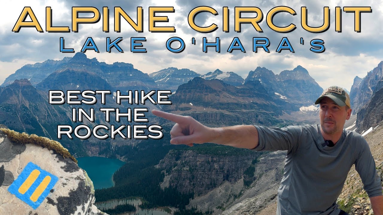
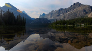
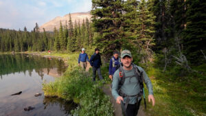
In this video, I complete one of the best hiking trails in Canada: the legendary Alpine Circuit around Lake O’Hara in Yoho National Park. This insane 12-kilometer loop takes experienced hikers through some of the most spectacular alpine terrain in the Canadian Rockies, showcasing the five alpine routes that sit above the O’Hara basin. It’s a journey that demands comfort with route finding, exposure to heights, and the ability to traverse challenging terrain.
The Alpine Circuit represents more than just another trail in the Rockies. It’s a testament to the vision and hard work of trail builders who spent decades creating safe passage through this incredible alpine environment. For hikers who are prepared for the challenge, this circuit offers an unforgettable experience combining stunning scenery, fascinating history, and the raw beauty that makes this region so special.
In my video below, I walk through the experience exactly as shown and explained:
Understanding the Alpine Routes
The alpine routes above Lake O’Hara are specifically designed for experienced hikers. These aren’t your typical well-maintained trails with clear signage at every turn. Instead, they’re routes that require real backpacking and hiking skills, including the ability to navigate using cairns and painted markers.
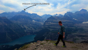
The five alpine routes that make up this system include Wiwaxy Gap with the Huber Ledges, Yukness Ledges, All Soul’s Prospect, Abbot Pass, and Odaray Grandview. Each of these routes presents its own challenges and rewards, from scrambling on scree slopes to navigating boulder fields where the way forward is marked by distinctive blue and yellow symbols painted on the rocks.
It’s important to understand that these routes often see early season closures due to avalanche hazard. Even when officially open, hikers must maintain awareness of avalanche conditions year-round and follow proper protocols for travelling in avalanche terrain. This isn’t casual hiking territory—it demands respect, preparation, and the right skill set.
A Note About Odaray Grandview
There’s something particularly important to mention about the Odaray Grandview route. A voluntary program is currently in place to limit use of the Odaray Highline Trail, which provides access to this route. The reason is conservation: this area serves as a vital wildlife corridor. Hikers are encouraged to explore other trails first to help protect this important habitat. It’s a reminder that our enjoyment of these wild places comes with responsibility.
The Historic Trail Markers
One of the most fascinating aspects of the Alpine Circuit is the story behind those distinctive painted markers that guide hikers along the route. The system we see today is the result of decades of evolution and the dedication of several remarkable individuals who each left their mark on this special place.
George “Tommy” Link and Carson Simpson
The Alpine Circuit owes its existence to George “Tommy” Link and Carson Simpson, who first created these routes. Through the 1940s, these two trail builders worked tirelessly to establish most of the alpine circuit that we enjoy today. They put up the routes to Wiwaxy Gap and All Soul’s Prospect, as well as the Huber and Yukness Ledges.
The challenge they faced was obvious: in such rugged terrain with little to indicate where the trails were supposed to go, how do you help hikers find their way? Tommy’s solution was elegant and practical—he decided to mark the route with red and orange squares of paint on the rocks. These bright markers became the guiding beacons for hikers navigating the exposed alpine terrain.
Tim Auger Carries the Torch
Fast forward to 1969, when the legendary Tim Auger started working as the district warden at O’Hara. Tim became a protege of Tommy, who was by this time in his 80s but still passionate about the trails he had built. Tommy took Tim out to all the trails, showing him the routes and sharing his knowledge. By then, the original paint squares were fading after more than two decades of exposure to the harsh mountain elements.
In the early 1970s, Tim took on the task of maintaining Tommy’s legacy, repainting the red and orange squares to ensure future hikers could safely navigate these alpine routes. It was an act of preservation, keeping alive the work of the trail’s original creators.
The Transition to Blue and Yellow
The story takes another interesting turn when we move into the 1980s. Edwin Knox got his first trail crew job at Lake O’Hara, and he spent three summers working up at O’Hara. Edwin’s time there overlapped with an era of change—specifically, when the trail markers themselves were transformed.
During one of those summers, Edwin was on a crew that included Rob Hemming and Diny Harrison. Diny would later become the first woman in Canada to become a full mountain guide, but at this time she brought a different expertise to the trail crew. Having studied fine art in university, Diny understood the colour wheel in ways her fellow crew members didn’t.
From her knowledge of colour theory, Diny knew that two colours from opposite sides of the colour wheel would give the highest contrast and be the most visible to hikers. Even more importantly, this combination would be visible to those with colourblindness—a crucial consideration for safety in the alpine environment. Her choice was blue and yellow.
Armed with little stencils, small paintbrushes, and a couple of cans of paint, Edwin, Diny, and Rob went on a mission to paint the new squares on the alpine route. Those blue and yellow markers they painted decades ago are the same ones guiding hikers today, a lasting testament to thoughtful design and careful execution.
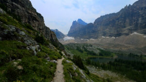
Navigating the Alpine Circuit
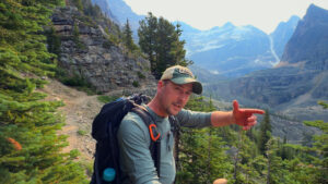
The 12-kilometer loop of the Alpine Circuit requires a different mindset than typical day hikes. You’re not just following a well-worn path through the forest. Instead, you’re often following cairns—carefully stacked rocks that indicate the general direction of travel—and those distinctive blue and yellow painted symbols that mark the way across boulder fields and rocky terrain.
Scrambling becomes a regular part of the experience. Scree slopes require careful foot placement and balance, while boulder fields demand constant attention and route-finding skills. The exposure to heights is real and sustained in places, making this circuit unsuitable for anyone uncomfortable with steep drop-offs or exposed traverses.
The rewards for this effort are extraordinary. The views from the alpine routes showcase the O’Hara basin from perspectives that few people ever experience. The sense of achievement that comes from successfully navigating these challenging routes is immense, and the connection to the history of the trail—knowing you’re following in the footsteps of Tommy, Tim, Edwin, Diny, and Rob—adds another layer of meaning to the journey.
Planning Your Visit
Attempting the Alpine Circuit requires more than just showing up at Lake O’Hara. The area is famous for its limited access, designed to protect this fragile alpine environment. Understanding seasonal considerations is crucial—those early season closures due to avalanche hazard aren’t suggestions, they’re serious safety measures.
Even when the routes are open, conditions can change quickly in the alpine environment. Weather can deteriorate rapidly, visibility can drop, and what seems manageable in good conditions can become genuinely dangerous when clouds roll in or wind picks up. This is why the emphasis on experience and comfort with route finding isn’t just bureaucratic caution—it’s essential safety advice.
The Broader Context
The Lake O’Hara Alpine Circuit sits within the incredible network of trails and experiences available throughout Yoho National Park. From Natural Bridge to Takakkaw Falls to Emerald Lake, Yoho offers endless opportunities for exploration. The Alpine Circuit represents the pinnacle of the park’s hiking opportunities—the ultimate challenge for experienced hikers who have built their skills on other trails.
This region of the Canadian Rockies, spanning Banff National Park, Jasper National Park, and Yoho National Park, offers some of the most spectacular mountain scenery anywhere on Earth. From iconic locations like Johnston Canyon, Lake Louise, and Moraine Lake in Banff, to Maligne Lake, Spirit Island, and Athabasca Falls in Jasper, to the unique character of Yoho itself, each park has its own personality and attractions.
The trail systems vary widely, from accessible walks suitable for families to challenging routes like the Skyline Trail in Jasper, Sentinel Pass in Banff, or the Iceline Trail in Yoho. For those planning trips to the region, understanding this range of options helps in creating an itinerary that matches your abilities and ambitions.
Practical Information
For those looking to tackle the Alpine Circuit or explore any of these mountain parks, having the right gear makes all the difference. Proper footwear with good ankle support and traction is non-negotiable for the rocky, uneven terrain. Layers for changing weather conditions, navigation tools, emergency supplies, and plenty of food and water are all essential.
I’ve found that tools like Campnab can be invaluable for securing campsites in these popular parks, especially during peak season. The link for camping cancellations through Campnab is available at https://campnab.com/r/s5nrrv. For detailed information about the gear I use on these adventures, you can find everything at www.EricTremblayAdventures.com/Gear.
If you’re planning your own adventures and want to see exactly where this trail and others are located, there’s a video map available at www.EricTremblayAdventures.com/map. These resources help transform the planning process from overwhelming to manageable, ensuring you’re prepared for whatever adventure you choose.
The Experience of Completing the Circuit
Completing the Alpine Circuit isn’t just about covering 12 kilometers and checking a box. It’s about immersing yourself in an alpine environment that challenges and rewards in equal measure. The scrambling over boulder fields, the careful navigation following those blue and yellow markers, the moments of exposure where you need to trust your footing and focus—all of these elements combine to create an experience that stays with you.
Knowing the history behind the route adds depth to every painted marker you pass. When you spot that blue and yellow square guiding you across a boulder field, you can picture Diny, Edwin, and Rob up here with their stencils and small paintbrushes, carefully marking the way. When you navigate a particularly challenging section of the Huber or Yukness Ledges, you can imagine Tommy and Carson working through the 1940s to establish these routes.
The Alpine Circuit represents the best of what makes hiking in the Canadian Rockies so special. It’s not the easiest trail, and it’s certainly not the most accessible. But for those with the skills, experience, and determination to tackle it, the rewards are immeasurable. The combination of natural beauty, physical challenge, and historical significance creates something truly unique.
This is what draws me back to these mountains again and again, exploring everything from the popular destinations to the hidden gems, from gentle valley walks to exposed alpine traverses. Since 2020, I’ve been documenting these adventures, sharing the experiences of exploring Jasper National Park, Banff National Park, Yoho National Park, and the surrounding areas of Alberta Parks and BC Parks.
Whether you’re researching where to stay in these parks, looking for campground review information, planning specific hikes like Tunnel Mountain or the Valley of the Five Lakes, or dreaming about iconic locations along the Icefields Parkway, the goal is always the same: to provide the information and inspiration that helps you plan your own unforgettable adventures in this incredible landscape.
The Lake O’Hara Alpine Circuit stands as a pinnacle achievement, a trail that demands respect and rewards those who come prepared. It’s a reminder of why we venture into these wild places, why we challenge ourselves on exposed ledges and boulder fields, and why the Canadian Rockies continue to captivate everyone who experiences them. From the vision of Tommy Link in the 1940s to the thoughtful marker redesign by Diny Harrison in the 1980s to the countless hikers who have carefully followed these routes since, the Alpine Circuit represents a shared legacy of mountain adventure at its finest.